THE CHALLENGE
Reimagine the risk analysis process using real-time satellite data and climate data.
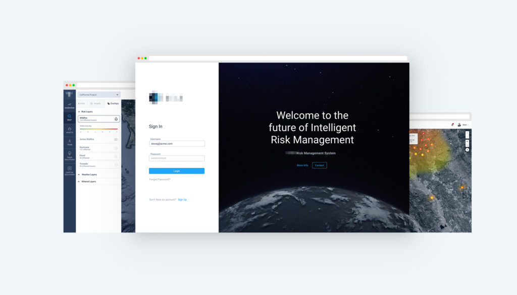
As part of an initiative to transform the customer experience in the InsureTech space, a aerospace satellite company needed a product that would allow risk officers from fortune 100 companies to manage their risk portfolio in real time. We worked as an embedded team in a modern agile environment to ideate, execute, test, and improve upon solutions against an extremely aggressive timeline.
Role: I served as UX Lead & Product Designer for the Product team over the course of 9+ month in an embedded client team. Led design vision from initial discovery, strategy, research, design and build.
Project Goals
ONE
Develop a better workflow for risk-assurance and asset management professionals and assist customers in making intelligent insurance decisions.
TWO
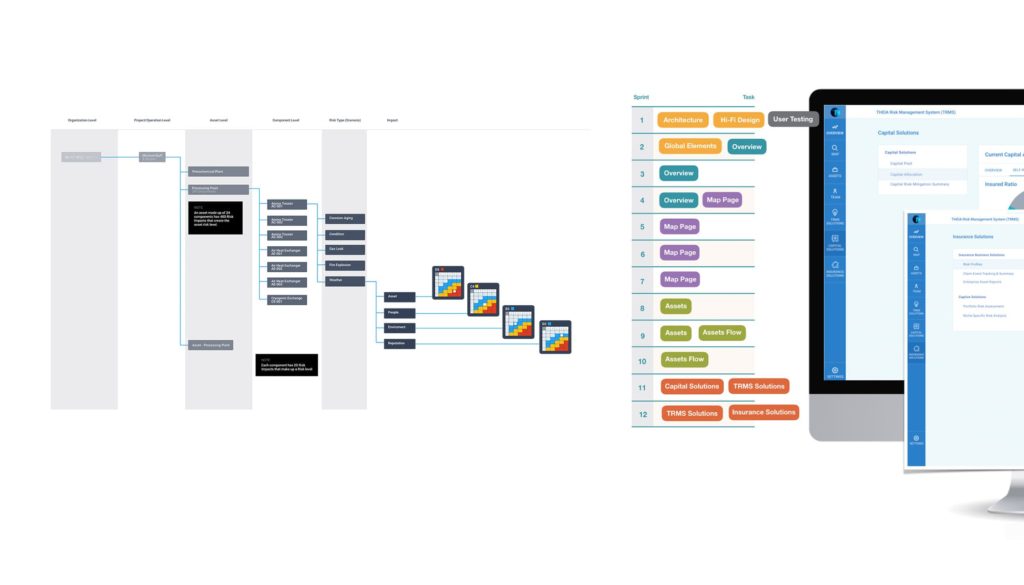
Define and champion the modern agile sprint process via a series of rapid 3-day sprints, to create a working integrated MVP product.
THREE
Set a new standard for insurance risk management with a real time and historical climate data dashboard and convert into a streamlined satellite monitoring digital product.
Problem
Insurance risk has to be handled manually and gets very complex in many industries that have to deal on a global scale. With changing weather conditions and an ever growing list of assets it becomes difficult to identify your most at risk assets and monitor them.
PROCESS
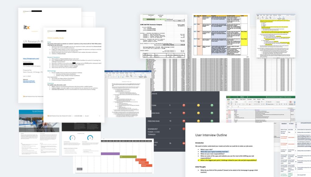
Initially we did not have a clear mission or even target area, there was simply a hunch from the CTO that we could use satellite data and climate data to drive value for insurers. Without pre-existing insights, I partnered with an C-suite actuary and research group out of Berkley to research competition and industry need. We started high level and mapped out scenarios with the highest level of success.
Innovating with top actuaries across different organizations and disciplines
Our team didn’t just simply integrate into the design process – we defined it. By clarifying day-to-day design activities and deliverable expectations, our cross-discipline agency + product teams were able to work in perfect synchrony.
Mapping Data for a personalized Experience
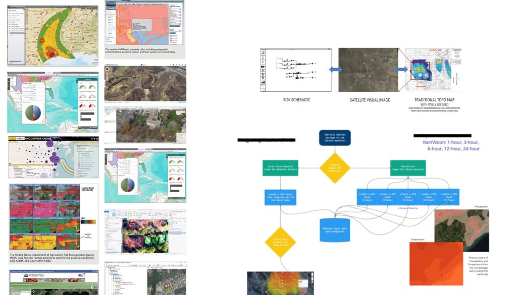
A platform as revolutionary as this required real data from multiple sources. We integrated with aircraft imagery, weather reports, historical weather damage archives, and partners such as IBM and HazardHub.
In an effort to keep the experience targeted to address each hazard, I worked with an insurance actuary and an innovation lead to identify what are the ideal data points for each hazard. Working backwards with our existing data sets we were able to create personalized hazard tracking experiences.
Design. Iterate. Repeat.
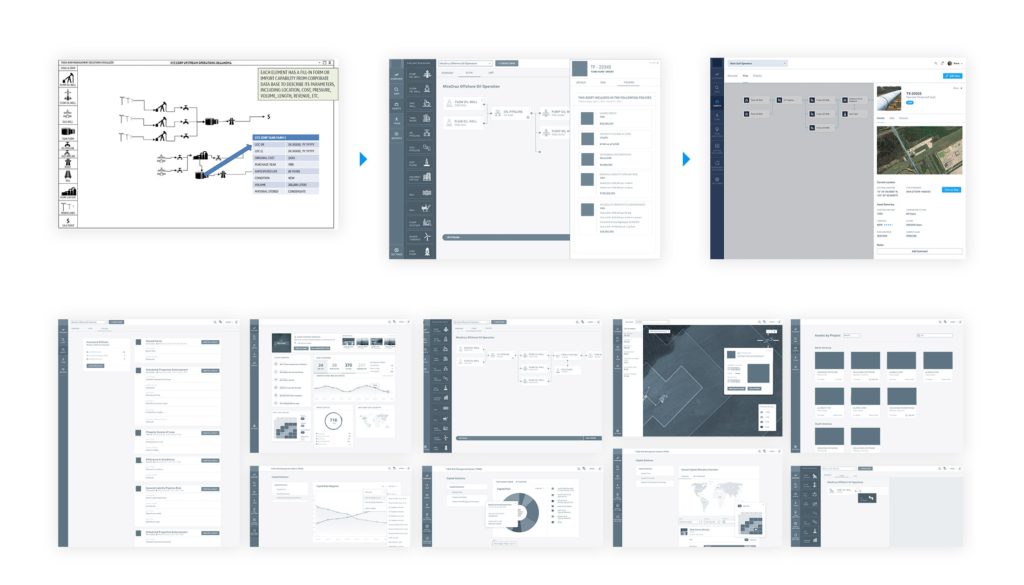
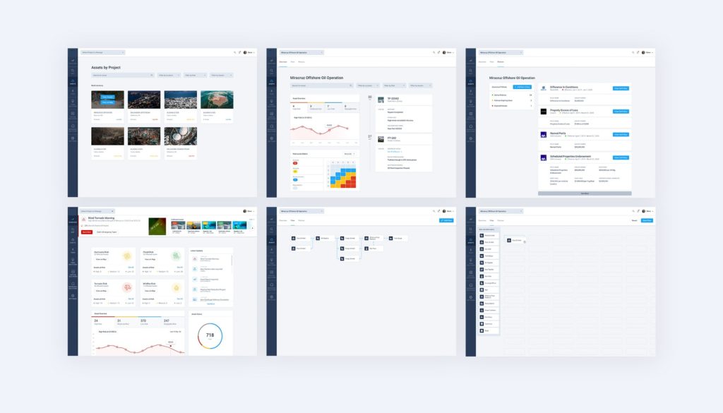
Low fidelity wireframes and collaboration sessions led to a high fidelity user flows and product concepts that were presented to different stakeholders and tested with insurance actuaries.
We learned that some of the risk ratings such as the risk matrix do not translate across different industry standards. We made the decision to move away from the typical risk matrix model used in oil and gas and focus on a wider array of industries.
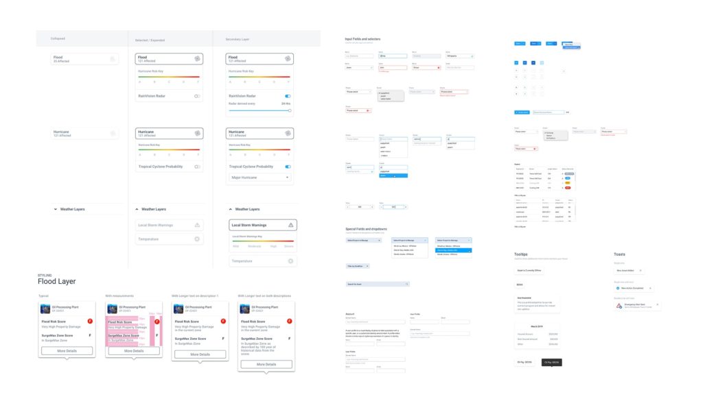
Although it required a higher upfront design investment building a consistent design system in Sketch and Zeplin allowed for the product team to be nimble and scale designs across multiple sub-products. Creating the design system early on enabled my design efforts to be spent on innovation and solving critical problems.
OUTCOME
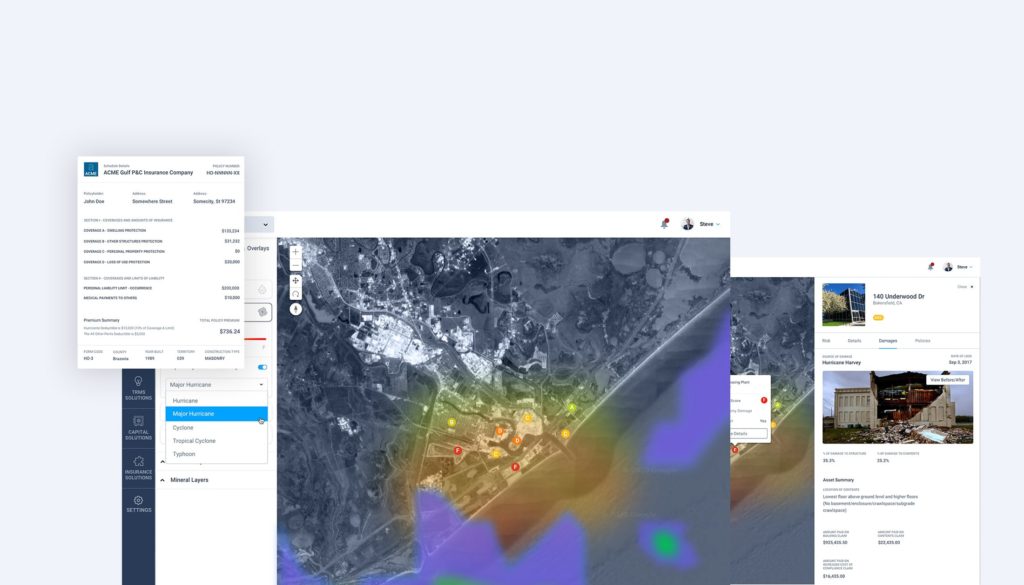
Successfully delivered a working prototype with live data that ensured client secured an additional round of funding, and acquired a strategic aerospace partner.
Usability testing with insurance risk officers captured excitement and ease of use.
FEEDBACK
“Great job delivering outstanding solutions and providing high-quality deliverables in the midst of changes.” Client CEO
Building Designs that don’t need to change even if our customers change directions! (Omitted) is a complex project taking geospatial data into the end-user, Slavic has delighted our customer cycle by cycle, this is a really difficult client whom changed direction every couple weeks, recently made another change from an Offshore operation in South America to a Western Gulf LNG Onshore and Offshore Operation in Freeport, Slavic handled it with elegance. Slavic designs were taken into consideration and applied perfectly for the purpose of building an agnostic solution regardless of the operation or location, Slavic assumed a key role in ensuring consistency and flexibility to deliver on time. Director of Engagement, ITX
